
Data Storage#
Database Format#
The Plugin uses a GeoPackage for data storage. It is a SQLite database with spatial extensions for storing vector and raster data. The GeoPackage or *.gpkg file is a binary file that stores data tables in SQLite format. SQLite is a public domain data base engine that is used and supported worldwide. More information about SQLite can be found at Here. The GeoPackage encoding system is approved by an Open Geospatial Consortium, a standard that is deemed sustainable by the U.S. Library of Congress (Library of Congress, 2017).
The FLO-2D Plugin uses the GeoPackage to store the data in a series of tables. The Plugin requires a single GeoPackage file for each project. The project units and coordinate reference system are defined in the GeoPackage at the start of the project.
See the Technical Reference Manual for an outline of the GeoPackage data. Find it here: C:\Users\Public\Documents\FLO-2D PRO Documentation\flo_help\Manuals
Warning
Do not remove the default layers and tables from the GeoPackage. It may break the structure of the project and the project may no longer load.
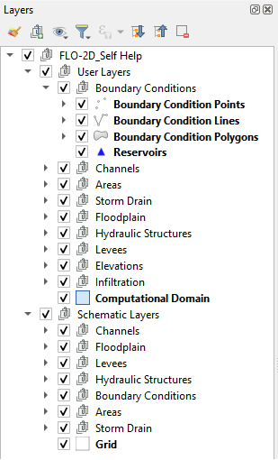
User Layers#
Data is arranged as vector layers and tables in the Plugin. The vector layers are organized as follows:
Points
Polylines
Polygons
There is a layer for each FLO-2D model component that is digitized by the user and schematized into the “schematic” layers and tables. These layers are used to define the schematized layers that are FLO-2D format. The layers can be directly edited using the general QGIS editor tools and the FLO-2D Editor Widgets. They can also be edited using the Attribute Table Editor and the Field Calculator.
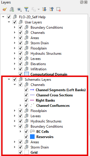
Schematic Layers#
The Schematic Layers are organized such that the Plugin can generate the FLO-2D *.DAT files from them. These layers, created by the schematizing tools, should not be manipulated by the user. The layers are vector layers with attribute fields that fill the FLO-2D data files.
QGIS Save#
The QGIS save button performs specific tasks when a FLO-2D Project is loaded. These processes are outlined in Save FLO-2D Project.