
3. Grid Elevation from GDAL Grid Method#
To interpolate the elevation to a grid layer from Point or Raster GDAL Grid Method, use this tool.
Sample Elevation#
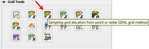
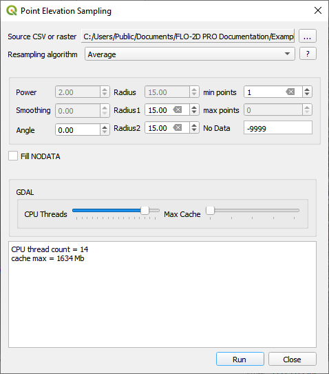
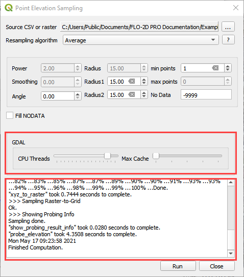
Click the Sampling grid elevation from point or raster file button and enter the required data in the dialog fields. As shown below.
Select the Fill NODATA option to set the elevation of empty grid elements from neighbors.
Click Run.
Note
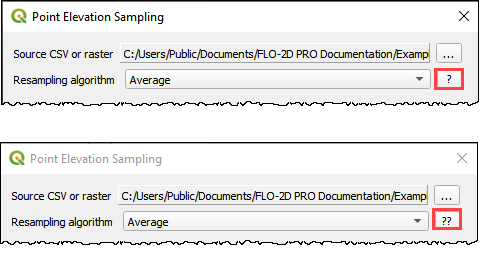
Use the help buttons to learn more about the GDAL Grid method. Click the button once to load a GDAL page with interpolation algorithm data and click the button again to load a GDAL grid tutorial.
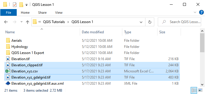
When the interpolation process is complete, several new elevation files are written to the project elevation directory.
The clipped elevation raster to eliminate excess data.
The elevation csv file is used for the interpolation.
The elevation_xyz_gdalgrid.tif is sampled to the grid layer.
A log of the interpolation process helps the user track the progress.
The user can set the CPU thread count and the memory cache allowed by the processors. This ensures the computer will not slow down while the optimized calculations are performed.
Once the Finished Computation message appears. Click Close.
Check this image here:
Troubleshooting#
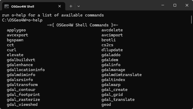
This tool requires DASK and DASK Distributed Python modules. Install them using the OSGEO4W shell. Run these commands.
o-help
pip install dask
pip install dask distributed
This process can be slow if the project has high resolution elevation data. If LiDAR point data is being used, try the LiDAR processor instead. If a high-resolution raster is being used, try the Sample Elevation from Raster instead.
If the elevation data has the wrong CRS or does not have complete coverage, calculation may still be performed but the elevation will be no good. Always spot check the elevation.
If the Finished Computation message is displayed but the grid table still has -9999 as the elevation, the raster CRS is not being read correctly. Save the data as a new layer and assign the correct CRS.