
11. Shallow n Spatial#
A spatially variable shallow n-value enables the flow roughness to be depth integrated to enable high n-values at shallow flow depths. Polygons can be applied to select individual or groups of grid elements to supersede the global n-value as in the case for streets and parking lots.
Note
The value can be globally assigned in the FLO-2D Control and Tolerance Variables window.
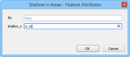
Digitize or Copy Data#
Select the Shallow-n Areas layer and click edit.
Create or copy the polygons that represent the shallow roughness areas to the layer and save them.
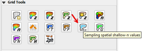
Sample Data#
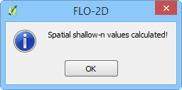
Click the Sampling Spatial Shallow-n Values button and then OK once the process is complete.
Troubleshooting#
Create the shallow-n polygons if they are missing from the Shallow-n Areas layer.
If the Grid layer is empty, create a grid and try again.
If a Python error appears during the sampling process, the attribute table may be missing. Save and reload the project into QGIS and try again.