
FLO-2D Info Tool#
Use the Info Tool to identify data in the User Layers and Schematic Layers. The layers must be active and checked on in the Layers panel. This tool also activates the Profile Tool widget.
Layers that work with this tool:
Channel layers
Left bank
Cross sections
Structure layers
Levee layers
This tool is a toggle. Toggle it on to activate it and toggle it off to stop using it.
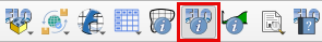
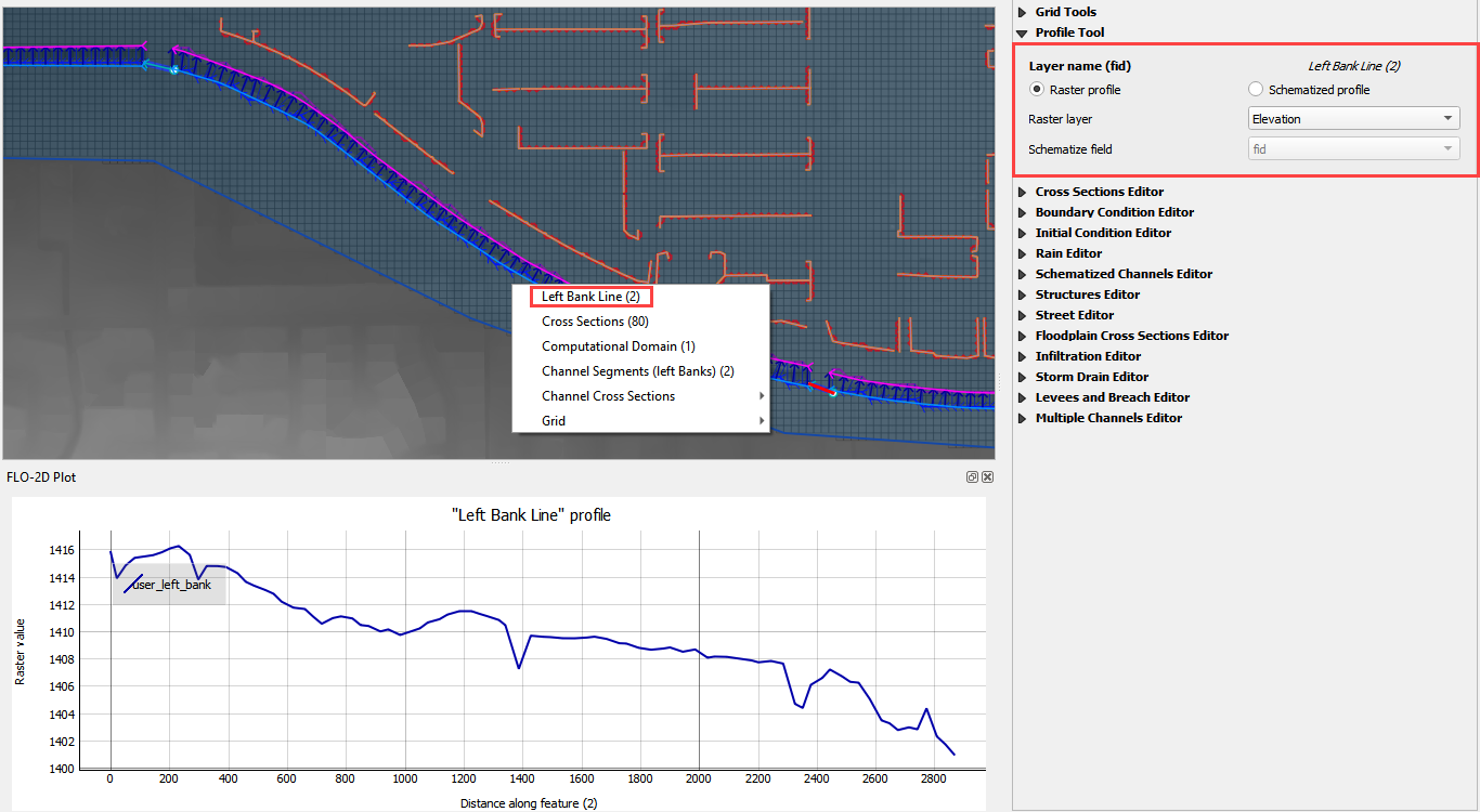
Channel Profiles#
Click the FLO-2D Info Tool.
Click a left bank user line. This option will plot the profile of the elevation file that intersects the left bank line.
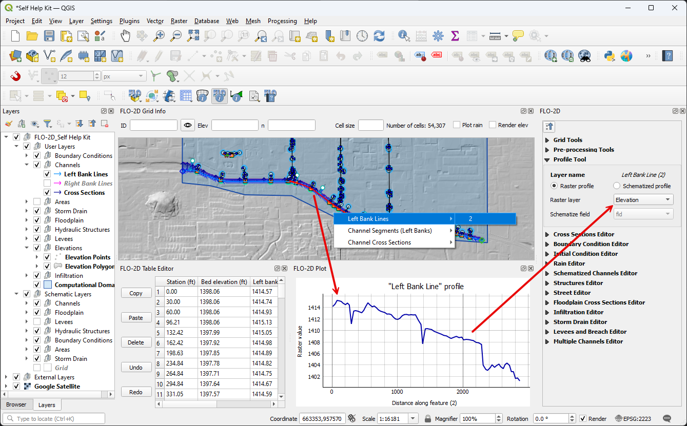
Click a left bank schema line. This option will plot the profile of the channel and load the bank and invert data into the table panel.
Use the Profile Tool widget to select the data plot source.
In this example, the elevation raster is the y axis and the left bank length is the x axis.
Channel User Layer Cross Sections#
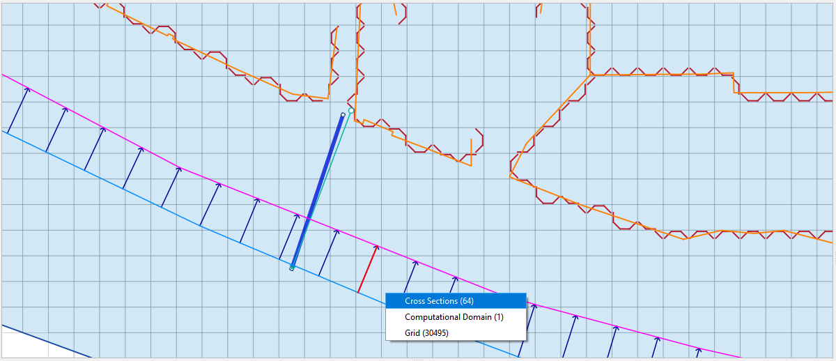
The FLO-2D info tool can be used to activate a specific user cross section.
Click the FLO-2D Info tool.
Click and select a User Layer cross section.
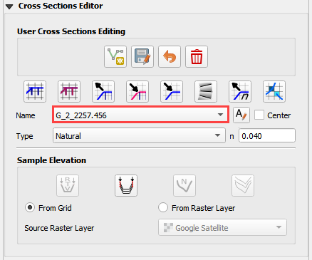
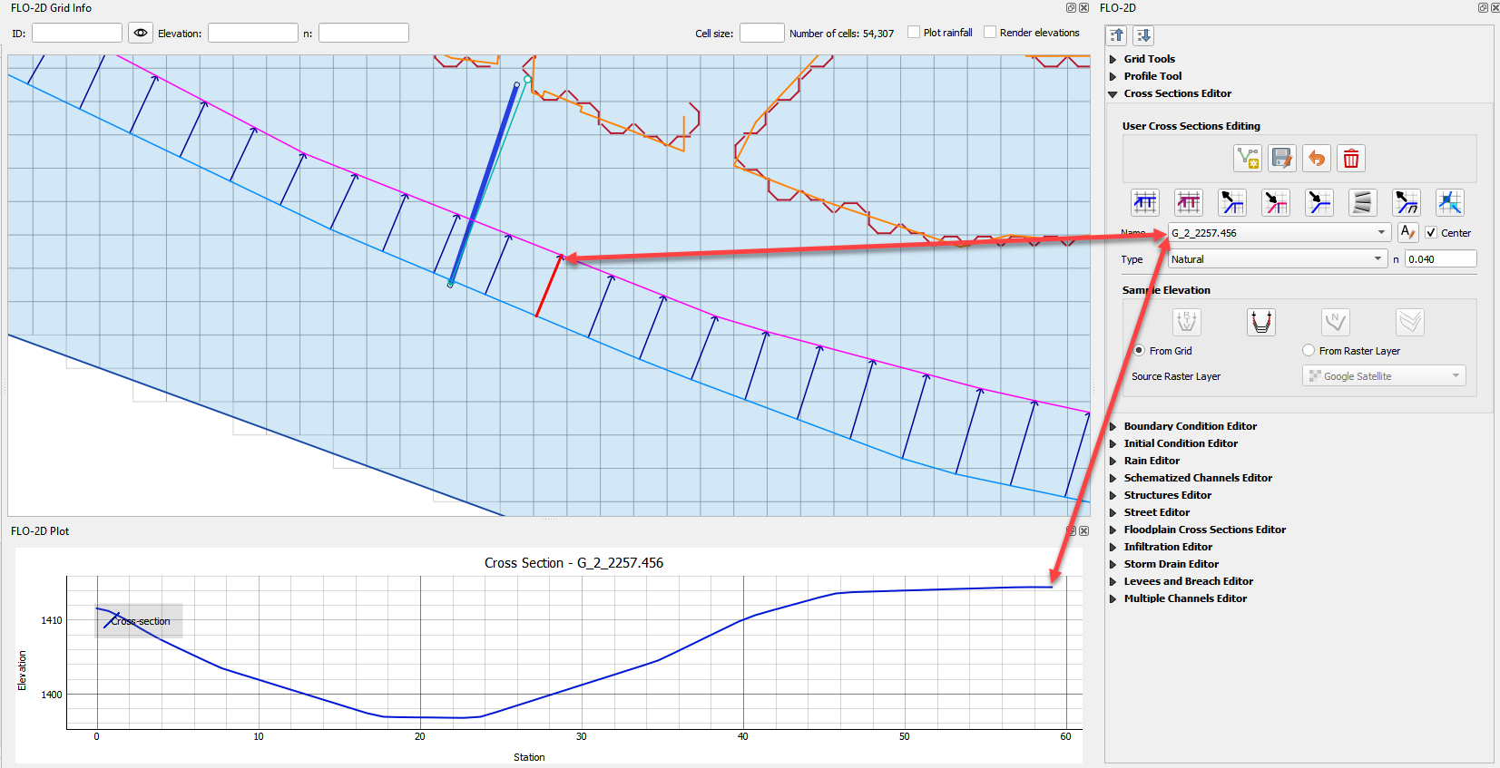
This cross section is loaded into the Cross Section Editor widget.
This cross section is also loaded into the FLO-2D Plot panel.
Ensure the tool is deactivated after use.
Channel Schematic Layer Cross Sections#
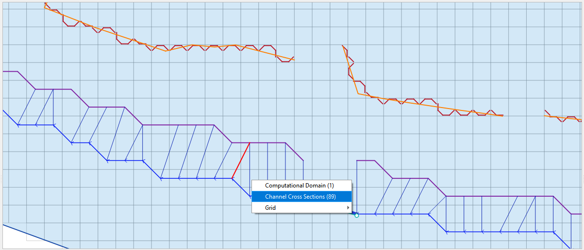
The FLO-2D Info Tool can be used to review schematized cross sections.
Click the FLO-2D Info tool.
Click and select a Schematic Layer cross section.
This cross section data is loaded into a dialog box.
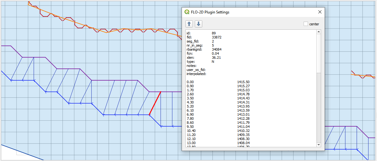
Ensure the tool is deactivated after use.
Structure Layers#
The FLO-2D info tool can be used to load and activate hydraulic structures.
Click the FLO-2D Info tool.
Click and select a structure line.
This line is loaded into its editor and plotted.
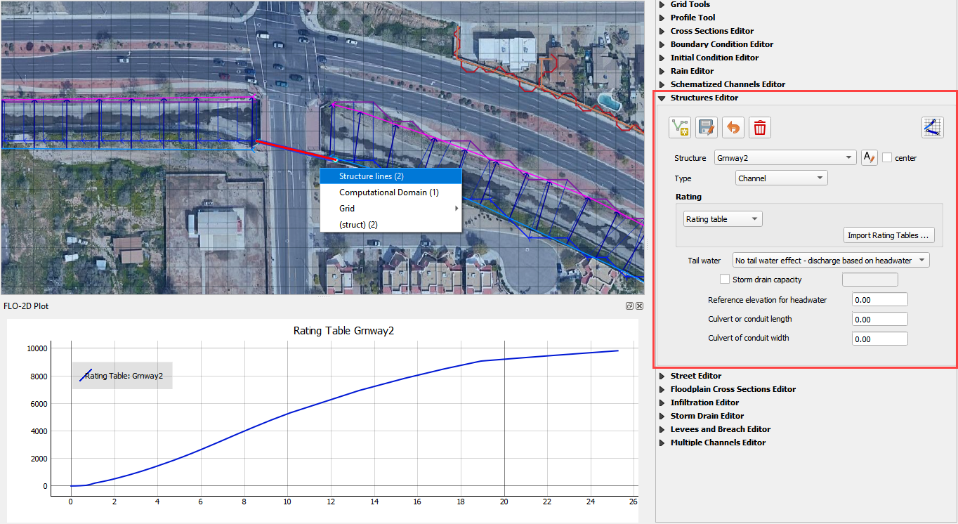
Ensure the tool is deactivated after use.
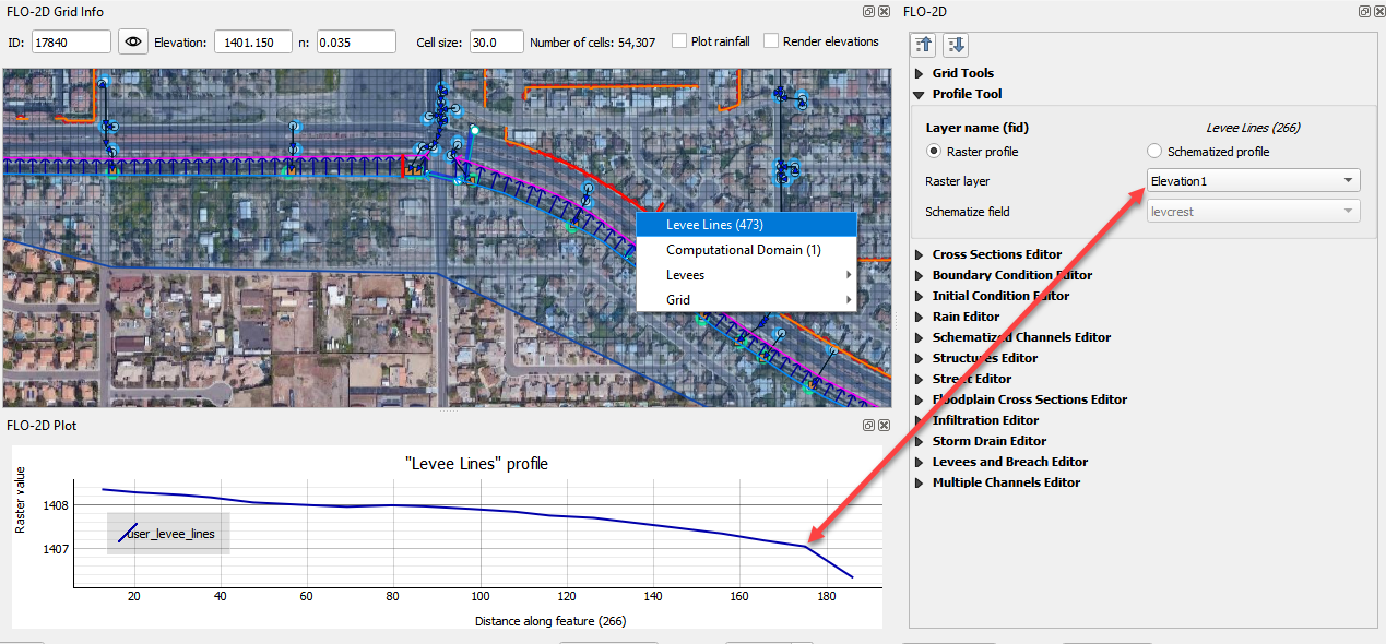
Levee Layers#
Levee Lines The FLO-2D info tool can be used to load the raster and levee schematized data profile of the levee lines.
Click the FLO-2D Info tool.
Click and select a Levee Line.
This line is loaded into the Profile Tool widget and plotted.
In this case, the elevation raster is plotted.
In the schematized profile case, the levcrest field is plotted.
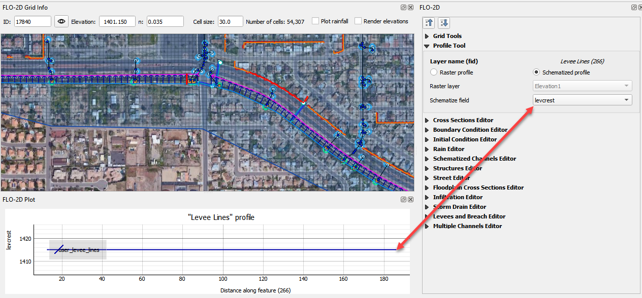
Ensure the tool is deactivated after use.