Mudflow#
Overview
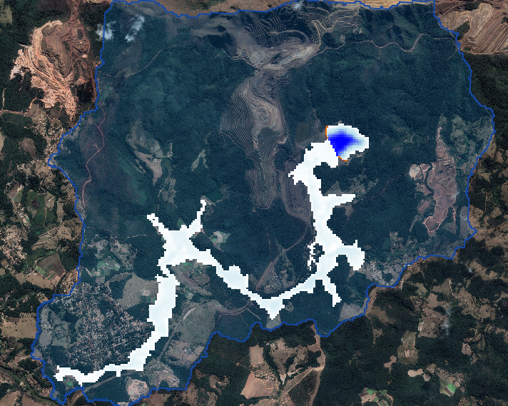
In this tutorial, a dam failure with mudflow is created. The dam releases a mudflow that advances downstream. The affected area is known as well as marks for the floodwave progression that are used in this lesson to compare with FLO-2D Results.
Required Data
The required data is provided in the previous lesson.
Note
Now we will add the tailings data to the model and run the prescribed breach failure again.
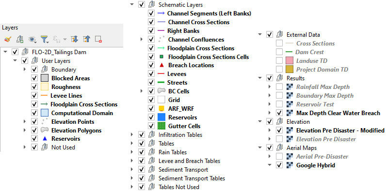
Step 1: Organize layers#
Good layer management is important. It keeps the project well organized and prevents layers from being lost. These images show some layer groups that make data management easier.
Group layers that are not used.
Group like data sets such as elevation, results, and external data.
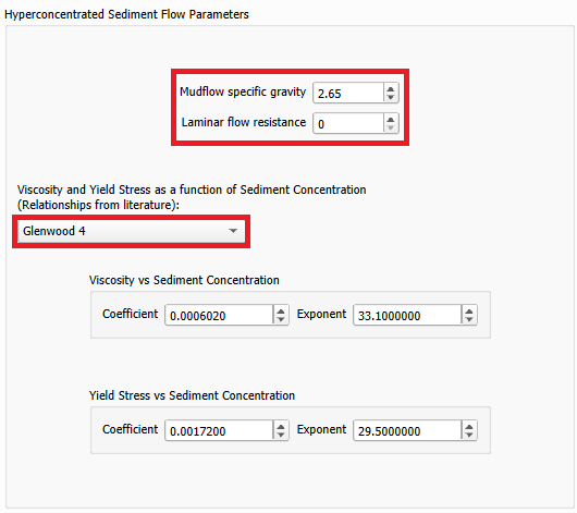
Step 2: Define mudflow properties#
Click on the Mud and Sediment Transport to set up the mudflow parameters.

Select the Mud / Debris Transport to set up the mudflow parameters.

Set the Hyperconcentrated Sediment Flow Parameters as follows and click ok:
Open the Control Variables and set the parameters as follows. Click save.
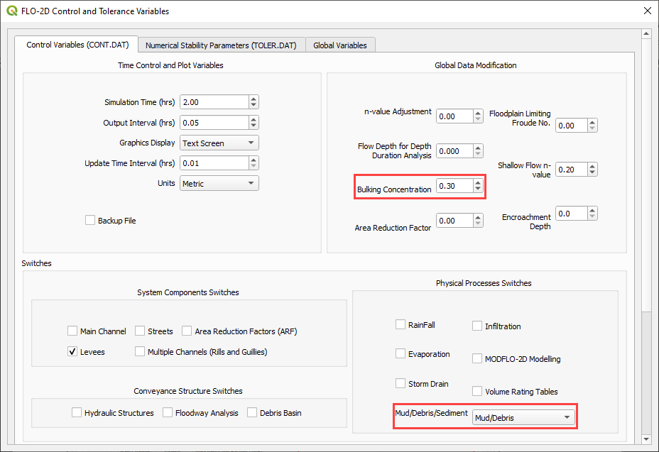
The bulking concentration is the volumetric concentration to bulk the inflow discharge hydrograph.
Step 3. Run the mudflow simulation#
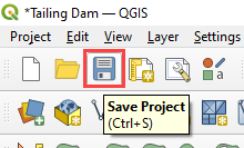
Click the main Save icon on the QGIS toolbar.
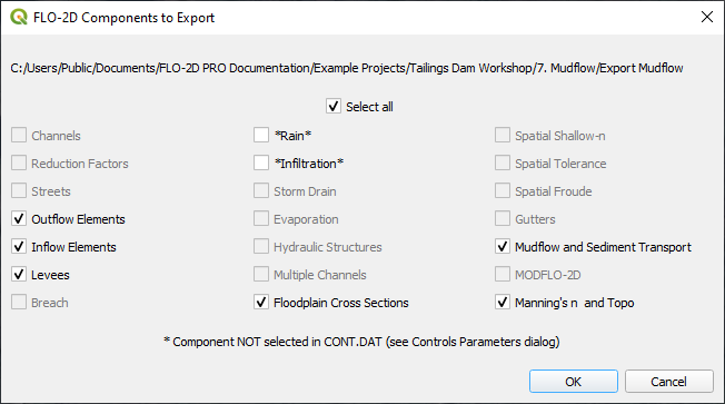
Click the FLO-2D Data Export icon, create a folder named Export Mudflow and select this folder. The Project Folder on the Run Settings is automatically updated to the new Export Mudflow folder, and it does not need to be updated.

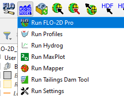
Click on the Run FLO-2D icon to run the simulation.
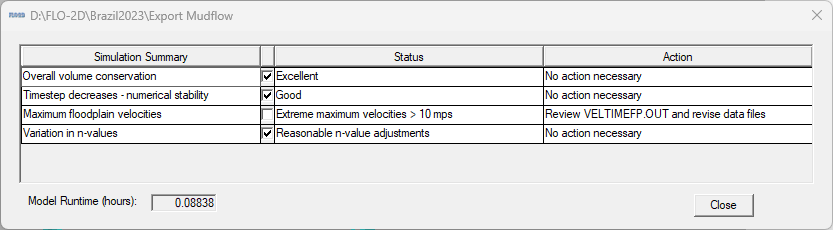
Check the simulation summary. Close the window.
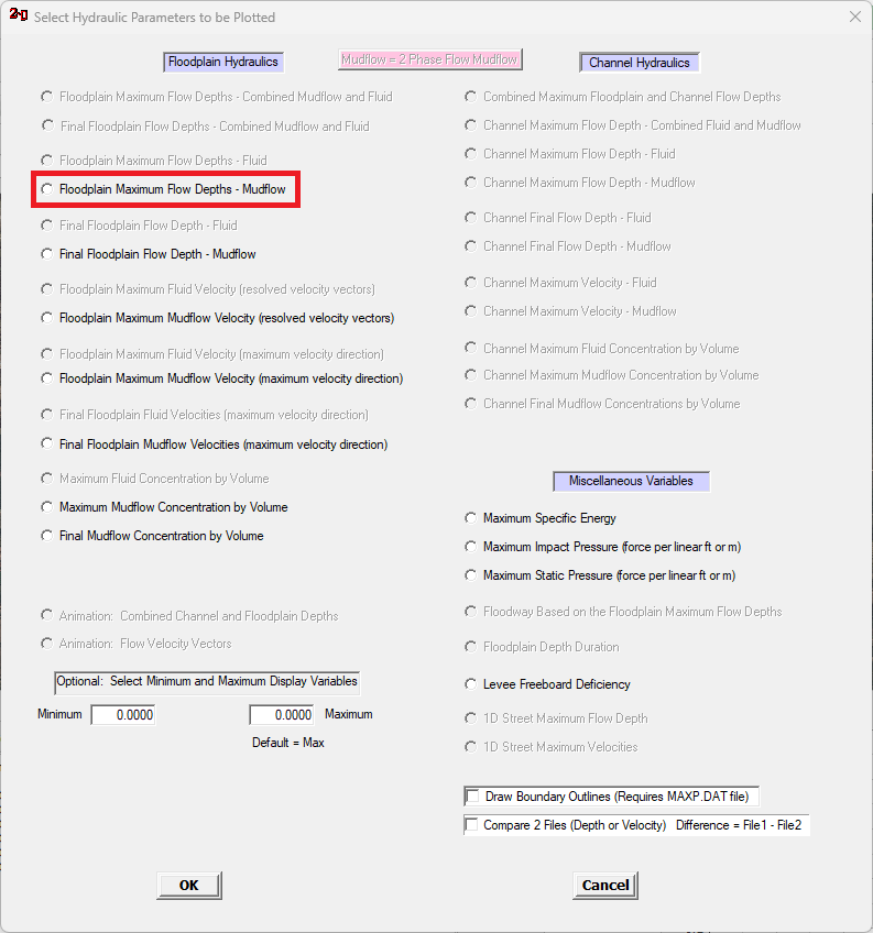
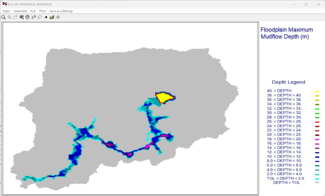
Step 4. Check the results#
Open MaxPlot or FLO-2D-Rasterizor to check the results.
MaxPlot: Select Floodplain Maximum Flow Depths – Mudflow
Use FLO-2D-Rasterizor to check the depth.out or finaldep.out