Urban Features#
Required Data
File |
Content |
|---|---|
*.shp |
Building Polygons |
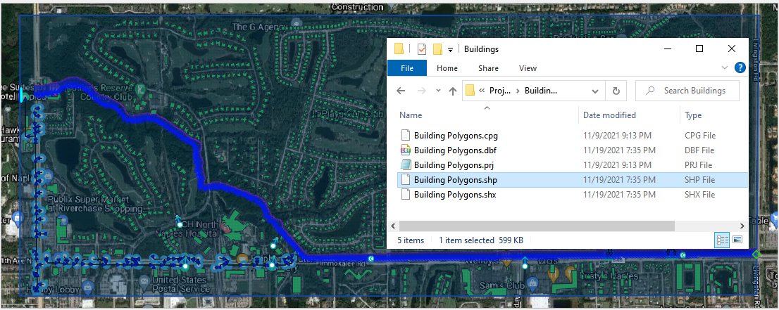
Data Location: \Coastal Training\Project Data\Buildings
Step 1: Load buildings#
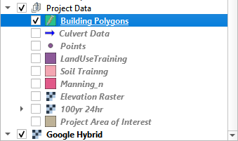
Click the Project Data Group.
Drag the Building Polygons shapefile onto the map space.
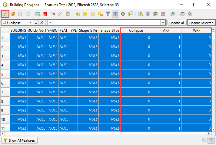
The Building shapefile requires 3 Attributes.
Collapse field; 0 = no collapse, 1 = collapse; (see Data Input Manual)
ARF field; 1 = assign area reduction
WRF field; 0 = no width reduction, 1 = assign width reduction
Step 2: Prepare the map#
Uncheck the Grid layer.
Uncheck the Elevation layer.
Check the Google image.
Uncheck the Outfalls, Inlet Junctions, and Conduits in the User Layers group.
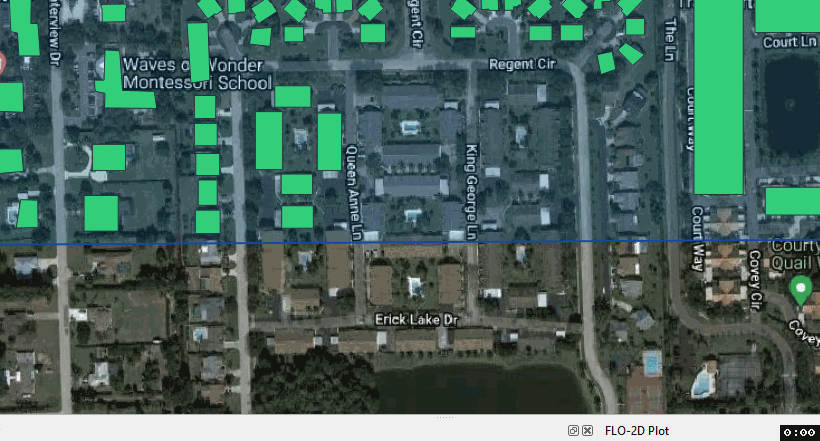
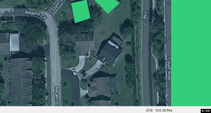
Step 3: Digitize missing buildings#
Click the Building Polygon layer.
Right click the layer and click the Edit Pencil.
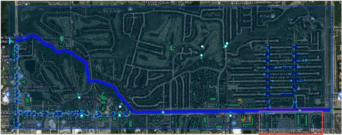
Zoom in to the lower east side of the grid.
Right click the top of QGIS near the Tool Bars and Click the Shape Digitizing Toolbar.
Click the Add Rectangle button.
Center the map on the missing buildings and use the cursor to cover them with a polygon.
Left click one corner of the building.
Move the cursor to the opposite corner and right click to close the polygon.
Fill the 3 required attributes and click OK. 0 collapse, 1 ARF, 0 WRF
To digitize a building that is disoriented, use the 3 Point option.
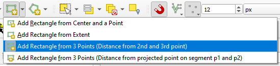
Click one corner of the building.
Click the adjacent corner.
Move the cursor to the opposite side of the building and right click to close the polygon.
To digitize a non-rectangular structure, use the regular Add Polygon button.

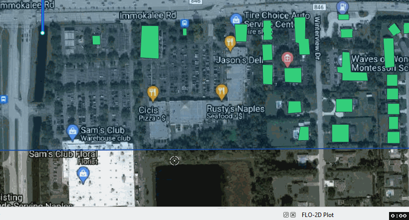
It is faster to digitize all buildings and then fill in the missing data using the Attributes Table.
Make a mistake?
Delete key will delete the last vertex.
ESC key will delete the current polygon.
CTRL-Z will undo the last completed task.
Leave a buffer between any building and the edge of the grid.
Covered parking structures and pools do to change the flow direction or displace volume.
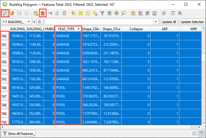
Sort the buildings by FEAT_TYPE. Select the GARAGE and POOL features using the line numbers. Delete them.
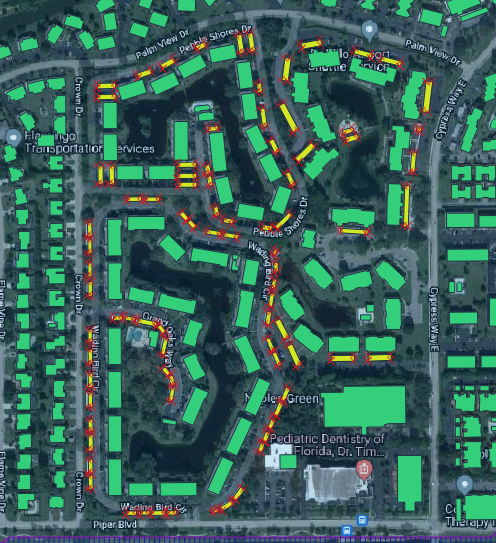
Step 3: Assign buildings#
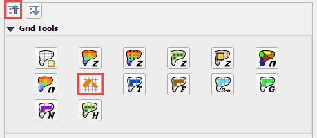
Collapse the widgets and select the Grid Tools.
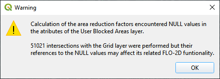
Click the Evaluate Reduction Factors (ARF and WRF) button.
Set up the parameters and click OK
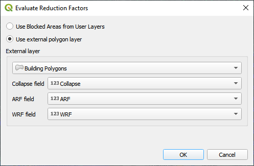
Close OK the window.