
Grid Tools#
Grid tools are used to sample various datatypes to the grid. It employs methods such as vector intersection to the grid layer and raster warp to the grid layer. The processes can use External data such as elevation files or data layers that are part of the geopackage. Each tool is described in this section.
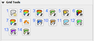
Create Grid
Grid Elevation from Raster Layer
Grid Elevation from GDAL Grid Method
Grid Elevation from LiDAR
Correct Grid Elevation
Grid Roughness from Vector
Grid Roughness from Raster
Reduction Factors (ARF and WRF)
TOL Spatial
Limiting Froude Spatial
Shallow n Spatial
Gutters
No-Exchange Channel Cells
Water Surface and Depth for HAZUS